Welcome to Acton's Stream Team


|


| FP6, Fort Pond Brook
|
- Upstream Border: RR tracks near Central Street crossing, north of Robbins St
- Downstream Border: Rte. 27 @ High Street
|
Team: Gabrielle Watson, Sieg Moyr, & Jim and David Corwin
|
|
|
Recreation, Canoeing, Fishing, Scenic Views
| |
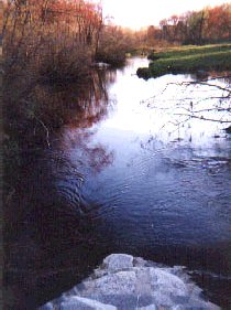
This segment begins downstream of Central Street, near the Heath Hen Meadow Brook confluence with Fort Pond Brook. A series of established walking trails takes you past open wetland expanses, along stone walls, and through wooded areas with woodland ferns and flowers. The Fort Pond Brook continues on, through a wooded area, to Martin Street, by the Jones Field playing fields. Possible canoe access exists here. Further on, the brook crosses Stow Street and runs by open farmer's fields before emptying into the upper lower Mill Pond.
Mill Pond is cut in half by a railroad bridge, the possible site of a future 'rail to trail' project that would connect South Acton to Marlborough via a bike/pedestrian trail. This section has HIGH potential for a Fort Pond Brook Trail!!
|
|
|
|
|
|